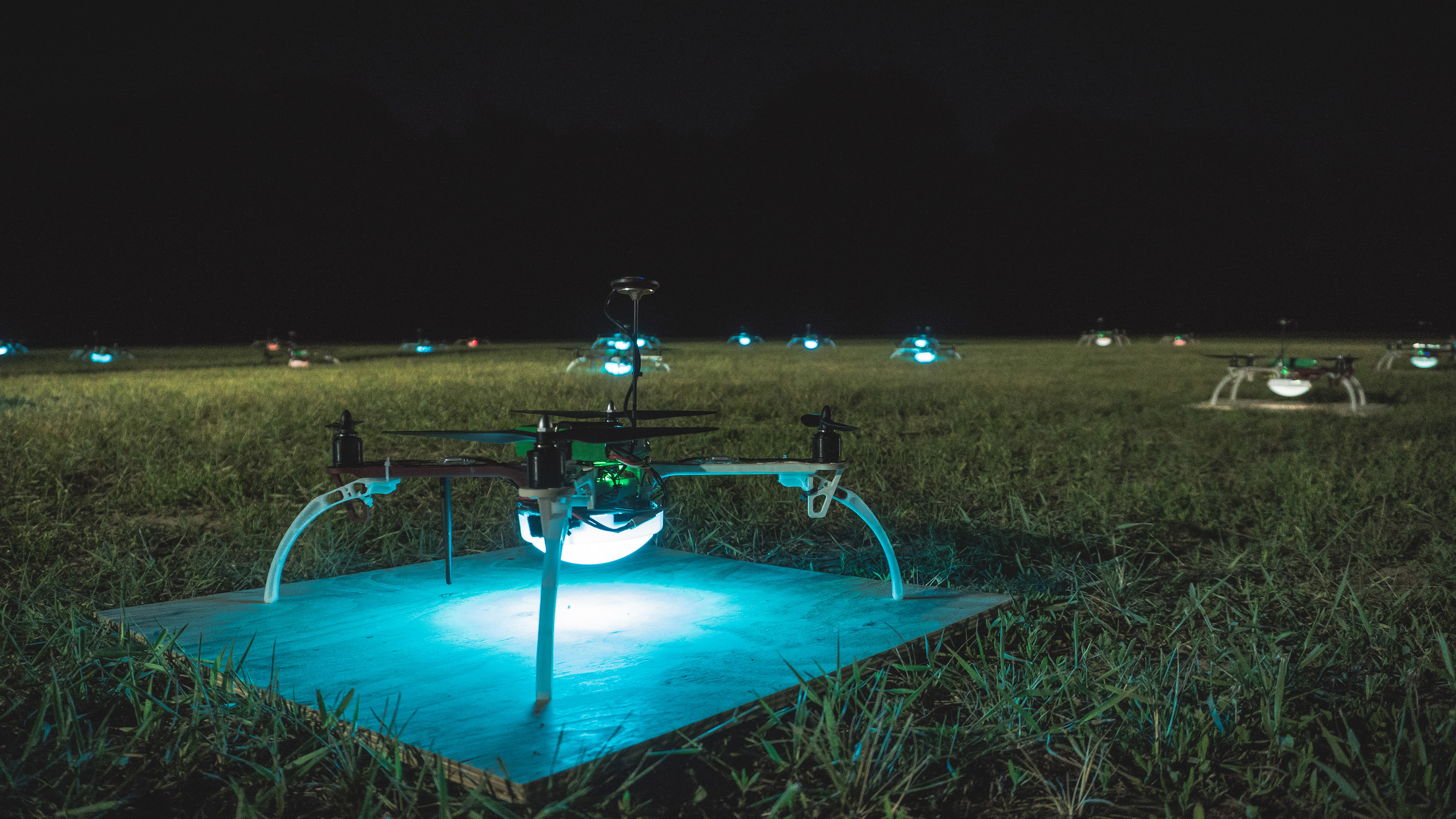
A Truly Immersive Experience… Drone shows in large public shows, theme parks, corporate events, weddings, product launches, opening of buildings, and advertising in sky and more. We have cutting-edge technology, to brand your story. Our team of professionals handle everything from storyboard design, animation, setting up the show to the final execution. We also offer fully customizable shows. Safety is our priority. Our drones communicate in the air to avoid collisions and to handle failsafe situations autonomously. Want to ask a question or get a drone show quote
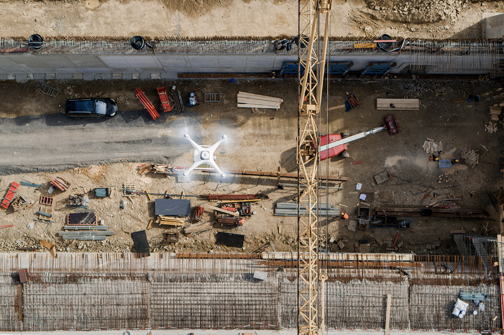
We are a drone services company engaged in aerial data acquisition,
analysis and reporting. We acquire, classify, analyse and report data via our AI-powered enterprise drone platform
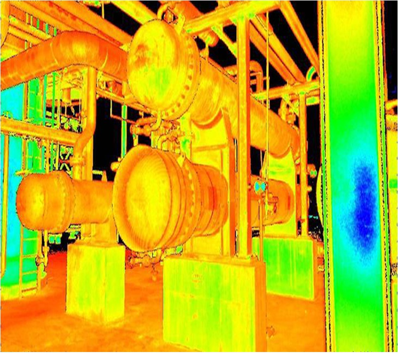
We conduct visual and thermal mapping, surveys and inspections.
Our services find many applications, including:
• Mapping greenfield projects
• Mapping forests and green zones
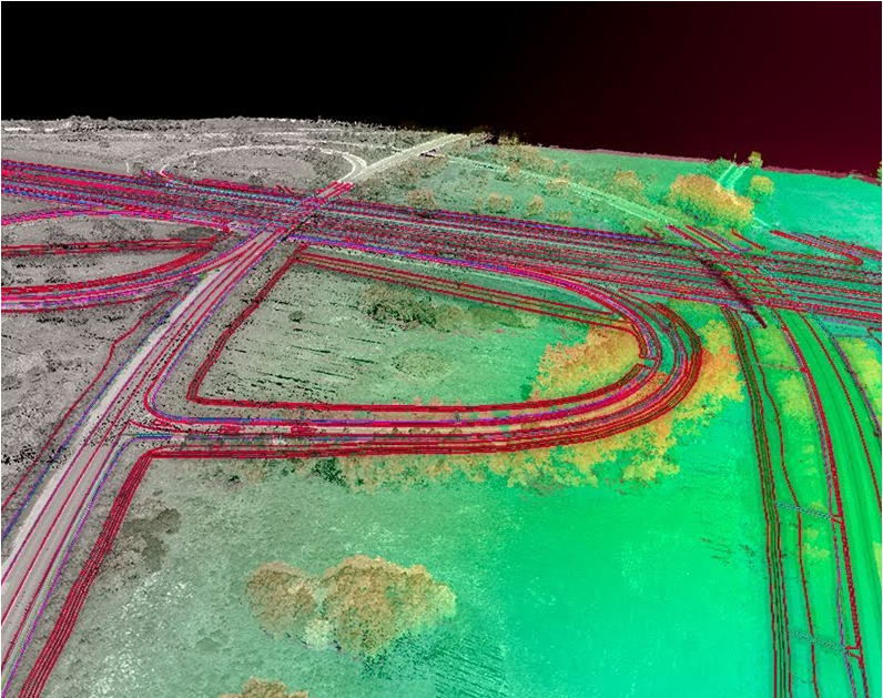
• Planning highway corridors
• Designing smart cities
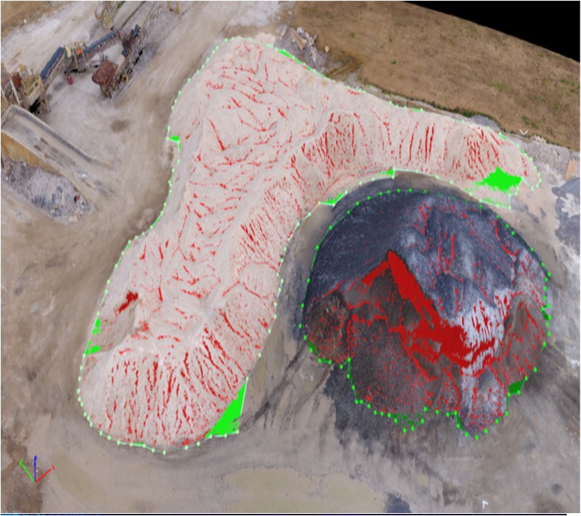
• Volumetric and stockpile calculations
• Monitoring construction progress
• Determining land slope stability for airports, dams and tunnels
• Inspecting power transmission and distribution networks
• Inspecting solar & wind farms
• Inspecting manufacturing plants, power plants and factories
• Live Exe uses best-in-class equipment while ensuring stringent regulatory compliance.
Continuous investments in the latest AI and IoT technologies help futureproof our platform
• Road's defect detection such as potholesand cracks.
• Alignment of Divider.
• Over line structures.
• Boundaries.
• Electric lines for Street Lights.
• Expansion of roads.
• Power lines crossings.
• Planning & Progress.
Transmission Line
• Mission Planner
• Live Inspection and UAV control through control room
• Automatic data syncing to Cloud
• Cloud Based Inspection and Reporting
• Aerial Mapping and Topographical survey
• 3D Profiling
• Working on AI integration to automate the inspection
• Cloud Based Inspection and Reporting
• AI tool integration to detect the anomalies automatically
• Cloud based dashboard to review 2D/3D, CAD drawings, perform various analytics.
• Topographical survey.
• Volumetric estimation.
• Toe and crest analysis.
• Environment Impact Analysis (EIA) support.
• Mine operations management.
• Project managementInspection & Monitoring.
• Real time quantity estimation.
• Financial estimation of a given stockpile.
• Live footage for anti-pilferage operations.
• Safety and surveillance monitoring.
• Mine productivity & profitability analysis.
AI–powered Mining Data Platform
MINING
• Mine-specific drone missions
• Geo-tagging of mines and stockpiles
• Real-time progress monitoring
• Change detection of stock piles
• Automated cut-and-fill
• Volumetric estimations
• Automated mine operations management
• Integration with customer ERP/SCM via API
Oil & Gas
AI–powered Mining Data Platform
• Mine-specific drone missions.
• Geo-tagging of mines and stockpiles.
• Real-time progress monitoring.
• Change detection of stock piles.
• Automated cut-and-fill.
• Volumetric estimations.
• Automated mine operations management.
• Integration with customer ERP/SCM via API.